Castle Dale One Place Study · Maps
Castle Dale,
1890
Ten years after the townsite was surveyed, and two years before the county built its brick courthouse, what did Castle Dale look like? Nobody photographed it from above. These four interactive models are an attempt to see it anyway — the same town, rebuilt four ways from the surviving maps.
- Lat.
- 39°12′ N
- Long.
- 111°01′ W
- Elev.
- ≈ 5,660 ft
- Plates
- I–IV
How to read these models
Each reconstruction lays the town’s 1880 street grid over real terrain, then fills the blocks with houses, gardens, ditches, and fields as they plausibly stood in 1890. The grid and a handful of dated buildings are documented. Most individual houses, fences, and crops are informed interpretation — representative, not recorded.
The four versions form a deliberate comparison: two rendering styles, each built with two different AI models working from the same source maps. Where they agree, the evidence is doing the work. Where they differ, you are looking at interpretation.
These are research sketches, not photographs. Each model has an “About” or “Field notes” panel explaining what is documented and what is inferred.
The Plates
Read across to compare AI models; read down to compare styles.
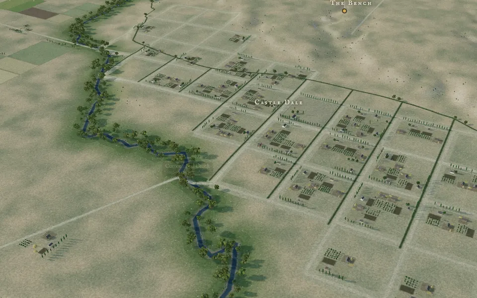
The Valley at Four O’Clock
A naturalistic landscape set on present-day USGS terrain, with Cottonwood Creek’s cottonwoods, lucerne and stubble fields, and the bench rising above town. Drawn on M. F. Shelton’s townsite survey of 28 December 1880.
- Drag the light slider through an afternoon of 20 September 1890
- Jump to preset views — Public Square, the bench, the Wasatch Plateau
- Overlay the 1880 plat’s blocks and lots
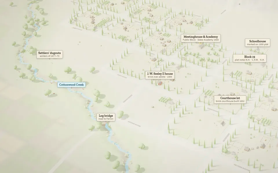
An Evidence-Graded Landscape
A soft, naturalistic rendering in which every labeled landmark is graded — documented from a record, or approximate. A reconstruction that shows its work.
- Click a landmark to read its evidence and grade
- Switch between bird’s-eye, plan, and street-level views
- Watch wagons move along the roads
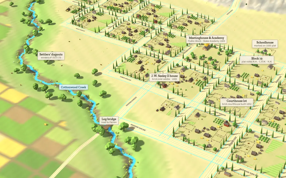
The Townsite in Full Color
A bright, model-railroad version of the town: log cabins, plastered adobe, rock and brick houses color-keyed by material, with the settlers’ dugouts, the log bridge, and the courthouse lot picked out.
- Toggle the 1880 plat block numbers
- Highlight the creek and irrigation ditches
- Set the camera to orbit the town
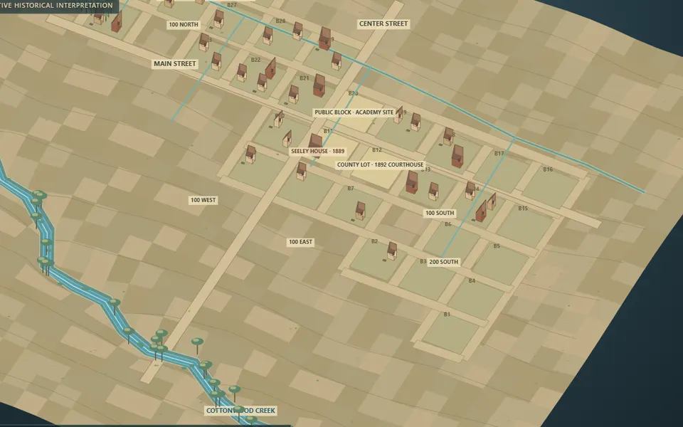
A Tabletop Town Model
A diorama on a tilted board, with every original block numbered and field notes explaining what is documented and what is interpretive. Buildings from later decades are deliberately left out.
- Turn, tilt, and zoom with the camera sliders
- Show 1917 Sanborn footprints as dashed “later clues”
- Click a building, street, or waterway to inspect it
Best on a laptop or desktop. On a phone, rotate to landscape and use one finger to turn, two to zoom.